Computers in Urban Studies
Jon Reades - j.reades@ucl.ac.uk
1st October 2025
All of this may seem very new and very scary if you have a ‘traditional’ background in Planning, Geography, or Urban Studies but…
3 Waves?
- “A computer in every institution”
- “A computer in every office”
- “A computer in every thing”
All Waves Still Going!
Wave 1: Computers help me do it faster
GIS is ‘just’ the industrial revolution impacting cartography.
Wave 2: Computers help me to think
Geocomputation & local stats are qualitatively & meaningfully different.
Wave 3: Computers help me to learn
Not ‘just’ about the ‘bigness’ of data, though that is important.
Anticipated by Hägerstrand (1967)
I think that the computer can do three different and useful things for us. The first and simplest operation is… descriptive mapping the second… is the analytical one The third kind of service is… to run process models by which we might try to reproduce observed or create hypothetical chains of events of a geographical nature.
Hägerstrand (1967)
But Persistent Critiques
More important, there is a clear disparity between the sophisticated theoretical and methodological framework which we are using and our ability to say anything really meaningful about events as they unfold around us. There are too many anomalies between what we purport to explain and manipulate and what actually happens. There is an ecological problem, an urban problem, an international trade problem, and yet we seem incapable of saying anything of any depth or profundity about any of them. When we do say something it appears trite and rather ludicrous.
Harvey (2008 [1972], 17)
Data science?
Source: Davenport and Patil (2012)
- Industry-led
- Spatially ignorant (often)
- Disciplinarily greedy (often)
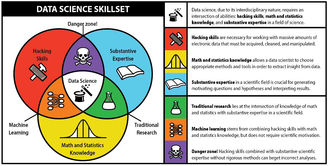
Source: Schneider (2013)
What is Different?
According to Donoho (2017) ‘data science’ differs from plain old ‘statistics’ through an interest in:
- Data gathering, preparation, and exploration;
- Data representation and transformation;
- Computing with data;
- Data visualisation and presentation;
- Data modelling; and
- A reflexive ‘science of data science’.
In Practice…
I think there are several distinguishing features that I encounter in day-to-day (geography) work:
- Data-driven methods development & deployment
- Explicit tuning/meta-parameterisation
- Explicit feature optimisation/engineering
- Explicit training/testing from ‘one shot’ data
- ‘Black boxes’ feature prominently & ‘online learning’ emerging quickly
Data science as process and pipeline, not just input to research.
Do We Need It?
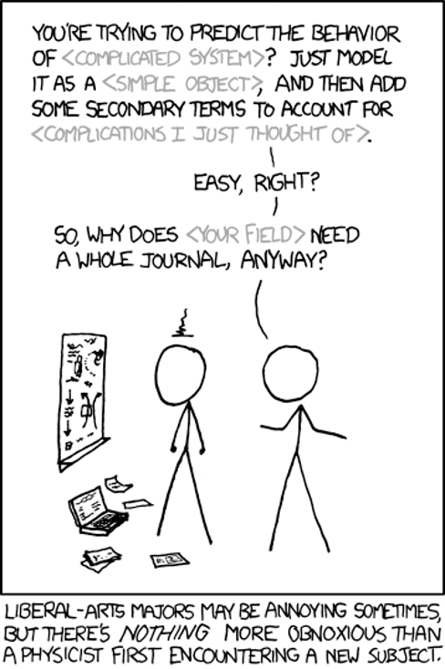
Source: xkcd
Additional Resources
- The Data of Urban Spaces — a nice collection of pieces on Towards Data Science