Exploratory
Data Analysis

Jon Reades - j.reades@ucl.ac.uk

1st October 2026
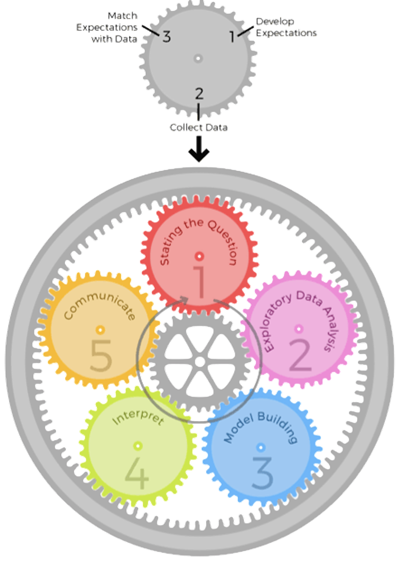
Diagram of the epicycles of data analysis: repeated loops of setting expectations, collecting data and revising

Epicyclic Feedback

Peng and Matsui, The Art of Data Science, p.8

Set Expectations Collect Information Revise Expectations
Question Question is of interest to audience Literature search/experts Sharpen question
EDA Data are appropriate for question Make exploratory plots Refine question or collect more data
Modelling Primary model answers question Fit secondary models / analysis Revise model to include more predictors
Interpretation Interpretation provides specific and meaningful answer Interpret analyses with focus on effect and uncertainty Revise EDA and/or models to provide more specific answers
Communication Process & results are complete and meaningful Seek feedback Revises anlyses or approach to presentation

Approaching EDA

There’s no hard and fast way of doing EDA, but as a general rule you’re looking to:

  • Clean
  • Canonicalise
  • Clean More
  • Visualise & Describe
  • Review
  • Clean Some More
  • …

The ‘joke’ is that 80% of Data Science is data cleaning.

Another Take

Here’s another view of how to do EDA:

  1. Preview data randomly and substantially
  2. Check totals such as number of entries and column types
  3. Check nulls such as at row and column levels
  4. Check duplicates: do IDs recurr, did the servers fail
  5. Plot distribution of numeric data (univariate and pairwise joint distribution)
  6. Plot count distribution of categorical data
  7. Analyse time series of numeric data by daily, monthly and yearly frequencies

In Practice

import pandas as pd
import geopandas as gpd
url='https://bit.ly/3I0XDrq'
df = pd.read_csv(url)
df.set_index('id', inplace=True)
df['price'] = df.price.str.replace('$','',regex=False).astype('float')
gdf = gpd.GeoDataFrame(df,
            geometry=gpd.points_from_xy(
                        df['longitude'],
                        df['latitude'],
                        crs='epsg:4326'
            )
      )

Getting Started

You can follow along by loading the Inside Airbnb sample:

import pandas as pd
import geopandas as gpd
url='https://bit.ly/3I0XDrq'
df = pd.read_csv(url)
df.set_index('id', inplace=True)
df['price'] = df.price.str.replace('$','',regex=False).astype('float')
gdf = gpd.GeoDataFrame(df, 
            geometry=gpd.points_from_xy(
                        df['longitude'], 
                        df['latitude'], 
                        crs='epsg:4326'
            )
      )

What Can We Do?1 (Series)

print(f"Host count is {gdf.host_name.count()}")
print(f"Mean is {gdf.price.mean():.0f}")
print(f"Max price is {gdf.price.max()}")
print(f"Min price is {gdf.price.min()}")
print(f"Median price is {gdf.price.median()}")
print(f"Standard dev is {gdf.price.std():.2f}")
print(f"25th quantile is {gdf.price.quantile(q=0.25)}")
Host count is 100
Mean is 118
Max price is 798.0
Min price is 15.0
Median price is 80.5
Standard dev is 123.87
25th quantile is 40.75

What Can We Do?1 (Data Frame Edition)

Command Returns
print(df.mean())
print(df.count())
print(df.max())
# ...
print(df.corr())
print(df.describe())
Mean of each *numerical* column
Number of non-null values in each column
Highest value in each column
...
Correlation between columns
Summarise

Measures

So pandas provides functions for commonly-used measures:

print(f"Mean: {df.price.mean():.2f}")
print(f"Median: {df.price.median():.2f}")
print(f"25th Percentile: {df.price.quantile(0.25):.2f}")
Mean: 118.45
Median: 80.50
25th Percentile: 40.75

More Complex Measures

Pandas also makes it easy to derive new variables… Here’s the z-score:
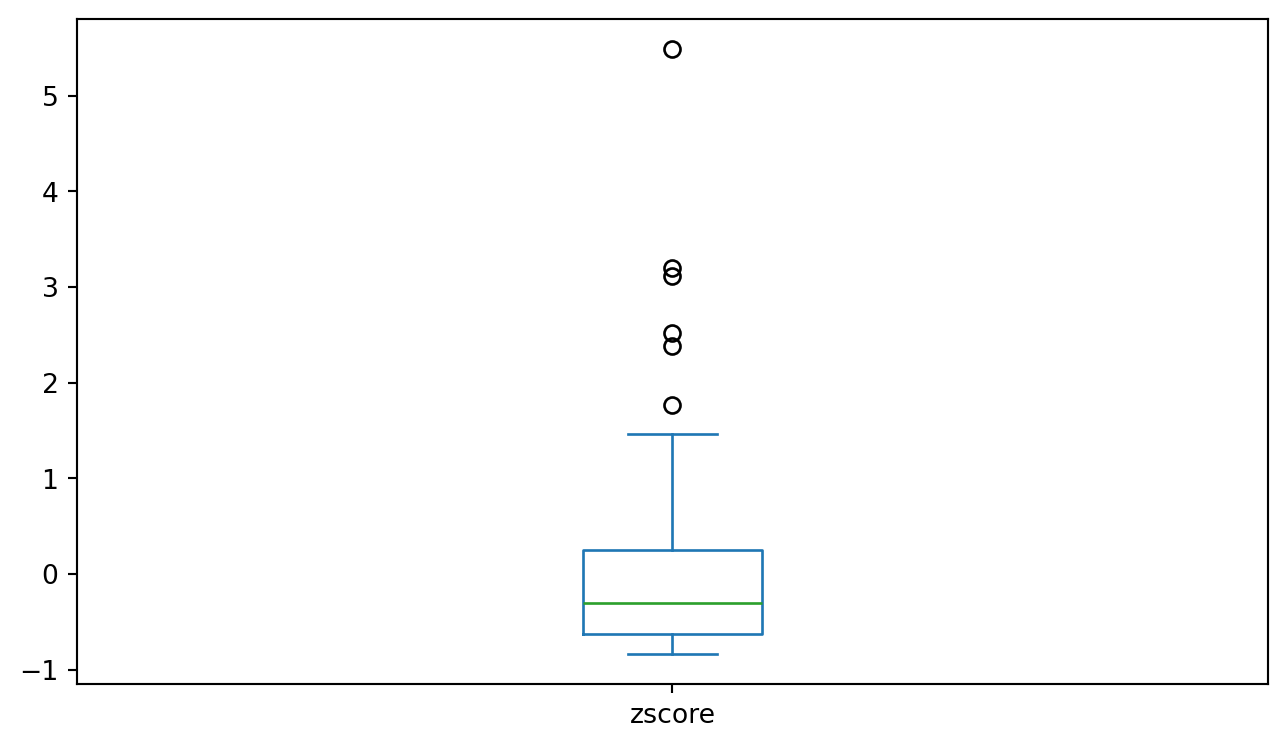
df['zscore'] = (df.price - df.price.mean())/df.price.std()
df.plot.box(column='zscore', figsize=(8,4.5))

Box-plot of z-scores

And Even More Complex

And here’s the Inter-Quartile Range Standardised score:
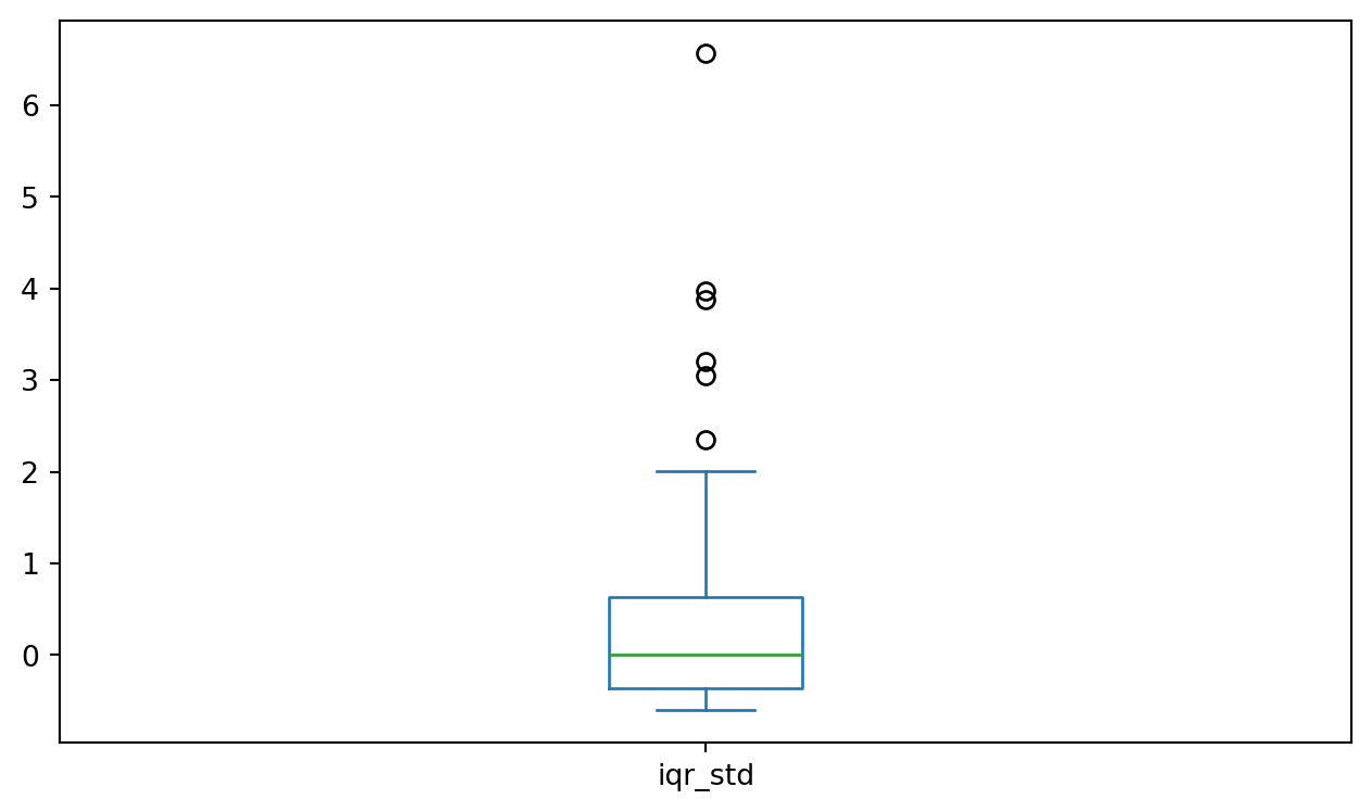
df['iqr_std'] = (df.price - df.price.median())/ \
      (df.price.quantile(q=0.75)-df.price.quantile(q=0.25))
df.plot.box(column='iqr_std', figsize=(8,4.5))

Box-plot of IQR standardised scores

The Plot Thickens

We’ll get to more complex plotting over the course of the term, but here’s a good start for exploring the data! All plotting depends on matplotlib which is the ogre in the attic to R’s ggplot.

import matplotlib.pyplot as plt

Get used to this import as it will allow you to save and manipulate the figures created in Python. It is not the most intuitive approach (unless you’ve used MATLAB before) but it does work.

Confession Time

I do like ggplot and sometimes even finish off graphics for articles in R just so that I can use ggplot; however, it is possible to generate great-looking figures in matplotlib but it is often more work because it’s a lot less intuitive.

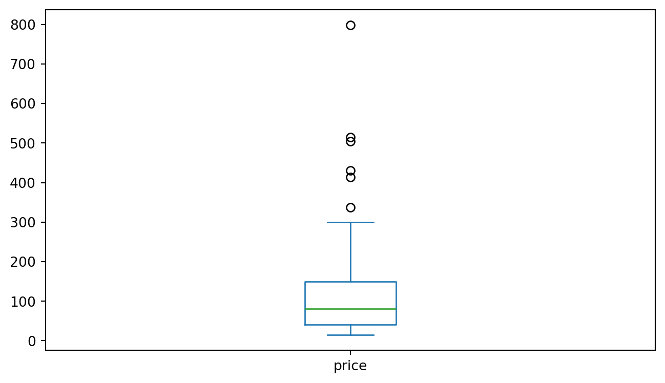
Boxplot

df.price.plot.box(figsize=(8,4.5))
plt.savefig('pboxplot.png', dpi=150, transparent=True)

Saving a boxplot of prices

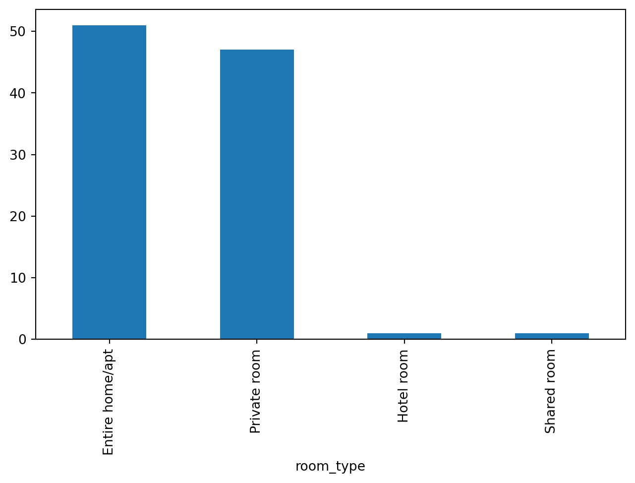
Frequency

df.room_type.value_counts().plot.bar(figsize=(8,4.5))
plt.savefig('phistplot.png', dpi=150, transparent=True)

Saving a histogram of room type frequencies

A Correlation Heatmap

We’ll get to these in more detail in a couple of weeks, but here’s some output…
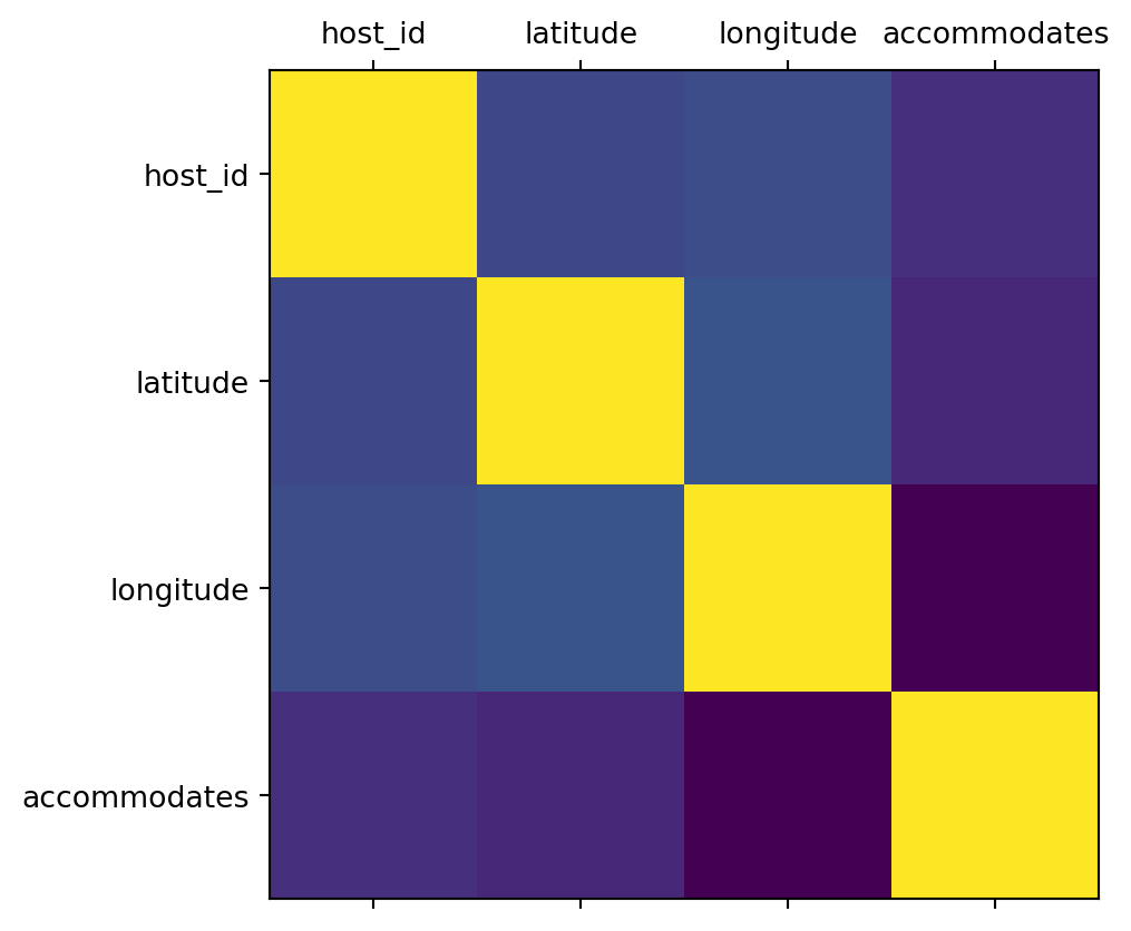
import numpy as np
cols = df.select_dtypes(
    include=np.number
).columns.to_list()[:4]
plt.matshow(df[cols].corr())
xaxis = np.arange(len(cols))
ax = plt.gca()
ax.set_xticks(xaxis)
ax.set_yticks(xaxis)
ax.set_xticklabels(cols)
ax.set_yticklabels(cols)

Correlation plot of numerical columns

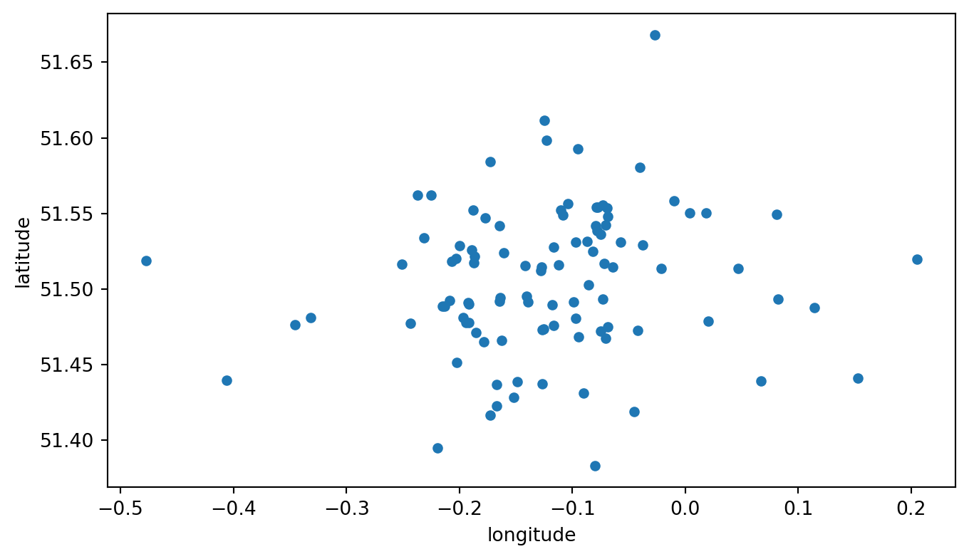
A ‘Map’

df.plot.scatter(x='longitude', y='latitude', figsize=(8,4.5))
plt.savefig('pscatterplot.png', dpi=150, transparent=True)

Saving a scatter plot of x/y coordinates

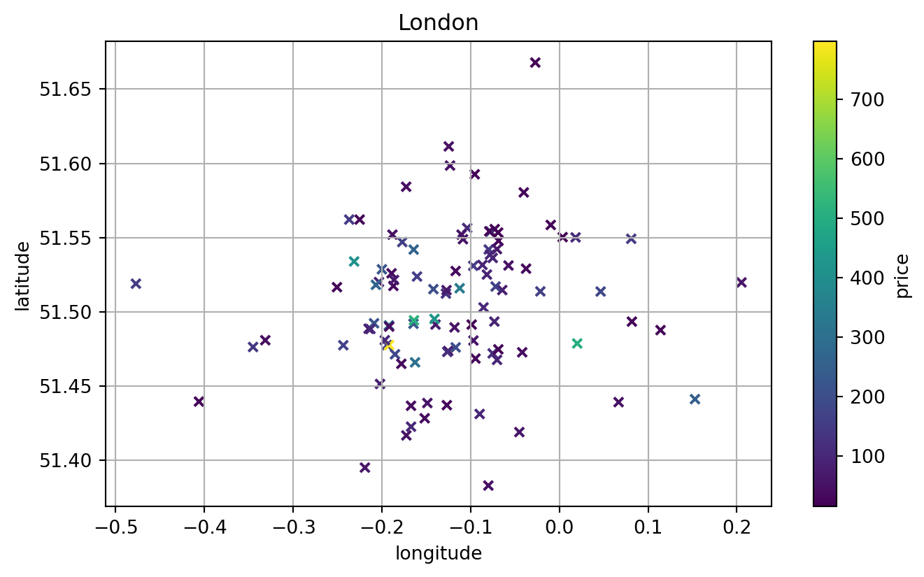
A Fancy ‘Map’

df.plot.scatter(x='longitude',y='latitude',
                c='price',colormap='viridis',
                figsize=(8,4.5),title='London',
                grid=True,s=24,marker='x')
plt.savefig('pscatterplot.png', dpi=150, transparent=True)

Adjusting a scatter plot of x/y coordinates to show prices too

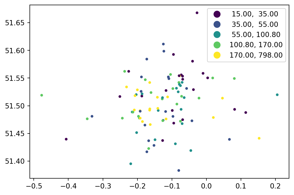
An Actual ‘Map’

gdf.plot(column='price', cmap='viridis', 
         scheme='quantiles', markersize=8, legend=True,
         figsize=(8,4.5))

Adjusting a scatter plot of x/y coordinates to show prices as quantiles

Additional Resources

There’s so much more to find, but:

Thank You

References